
REUNION (France)
Volcanic landscapes - Reunion National Park
Reunion is above a hotspot in the Earth's crust. The Piton de la Fournaise, a shield volcano on the eastern end of Réunion Island, rises more than 2,631 metres (8,632 ft). It has erupted more than 100 times since 1640 and is under constant monitoring. The Piton des Neiges volcano (extincted), the highest point on the island at 3,070 metres (10,070 ft) above sea level, is north west of the Piton de la Fournaise. Collapsed calderas and canyons are south west of the mountain. The slopes of both volcanoes are heavily forested. Few roads are crossing these volcanic landscapes, but it's possible to trek or to have a bird's eye with an helicopter tour. The Cirque de Mafate is a caldera and was formed from the collapse of the large shield volcano the Piton des Neiges. The very remote and inaccessible cirque was settled in the 19th century by maroon slaves (i.e. slaves who had escaped from their masters), then later by poor white laborers. Today the Cirque is still inhabited and some supplies have to come by helicopter. Reunion National Park is listed by Unesco since 2010.
BEST TIME to VISIT
REUNION
BEST TIME to TRAVEL to REUNION
From June to September

Bird's-eye on Reunion National Park - volcanic landscape

Reunion National Park - Bird's-eye on the Piton de la Fournaise, a shield volcano on the eastern end of Réunion Island, rises more than 2,631 metres (8,632 ft)

Bird's-eye on Reunion National Park - volcanic landscape

Bird's-eye on Reunion National Park - volcanic landscape

Bird's-eye on Reunion National Park - Lush volcanic landscape and waterfalls - here a small hydraulic power plant

Bird's-eye on Reunion National Park - village in a caldera (cirque)

Bird's-eye on Reunion National Park - few roads are crossing these rough volcanic landscapes

Bird's-eye on Reunion National Parke - Piton de la Fournaise - recent lava

Bird's-eye on Reunion National Park - few roads are crossing these rough volcanic landscapes

Bird's-eye on Reunion National Park - lush volcanic landscape with trees and giant ferns

Bird's-eye on Reunion National Park - volcanic landscape with a small lake

Bird's-eye on Reunion National Park - lush volcanic landscape

Bird's-eye on Reunion National Park - lush volcanic landscape

Bird's-eye on Reunion National Park - lush volcanic landscape and a small road

Bird's-eye on Reunion National Park - lush volcanic landscape - road and waterfall
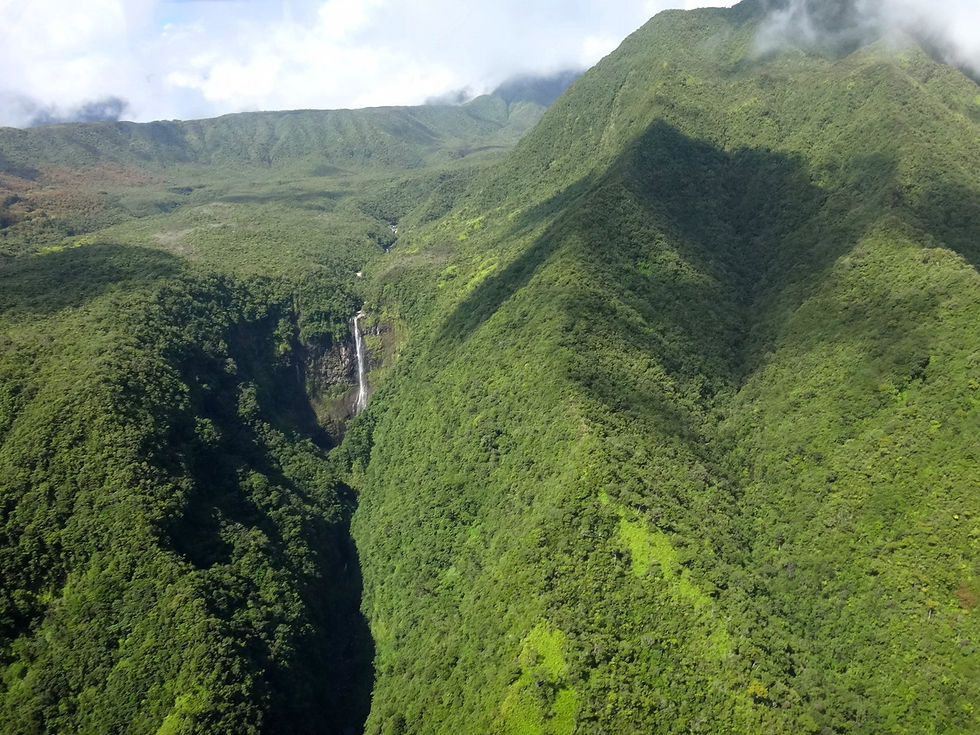
Bird's-eye on Reunion National Park - lush volcanic landscape - waterfall

Bird's-eye on Reunion National Park - lush volcanic landscape - waterfall

Bird's-eye on Reunion National Park - lush volcanic landscape

Bird's-eye on Reunion National Park - lush volcanic landscape - waterfall

Bird's-eye on Reunion National Park - volcanic landscape - village

Bird's-eye on Reunion National Park - volcanic landscape

Bird's-eye on Reunion National Park - volcanic landscape - village in a caldera

Bird's-eye on Reunion National Park - volcanic landscape and a small village

Bird's-eye on Reunion National Park - volcanic landscape

Bird's-eye on Reunion National Park - volcanic landscape - waterfalls

Bird's-eye on Reunion National Park - volcanic landscape and villages

Bird's-eye on Reunion National Park - volcanic landscape

Reunion National Park - Bird's-eye on the Piton de la Fournaise, a shield volcano on the eastern end of Réunion Island, rises more than 2,631 metres (8,632 ft)

around Cilaos - Palmiste Rouge village

Bird's-eye on Reunion National Park - few roads are crossing these rough volcanic landscapes

around Piton de la Fournaise - small crater

driving to Pas de Bellecombe near Piton de la Fournaise

around Piton de la Fournaise - volcanic landscape

around Piton de la Fournaise - volcanic landscape

driving to Pas de Bellecombe near Piton de la Fournaise

around Piton de la Fournaise - volcanic landscape